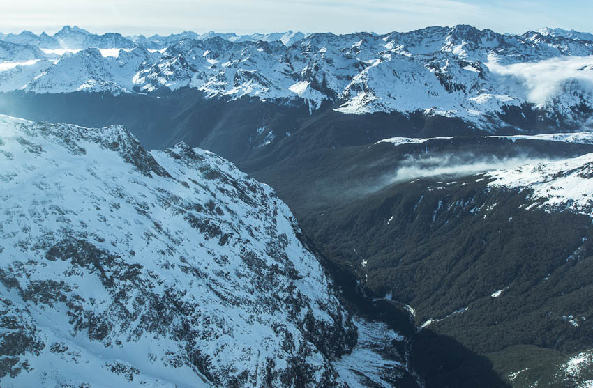
Hollyford Valley, Fiordland, New Zealand
Description: We flew along steep wall of Mt Christina. The view showed Hollyford Valley with visible junction of Milford and Hollyford roads. Behind are Ailsa Mountains. Viewpoint Key Summit is on the right of the picture (with snow cover). I used services of Fly Fiordland - www.flyfiordland.com
[display photography on the map]
Keywords: Fiordland, Mt Christina, New Zealand, Souhland, flight, mountains, Whakatipu Ka Tuka, Humboldt Mountains, Hollyford, Valley, Fly Fiordland, landscape, national park, World Heritage site, Te Wahipounamu, aerial photographs, aerial photography, aerial view, bird's-eye view, Key Summit, Ailsa Mountains, Humboldt Mountains
Exif: Exposure: 1/400, Aperture: 8.0, ISO: 200
Views: 10219 ×